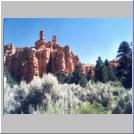
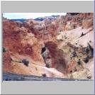
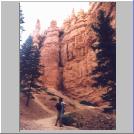
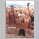
Bryce
Canyon isn't a Canyon, it's a long ridge of weathering rocks that have
formed fantastic shapes called Hoodoos along the cliff due to the
action
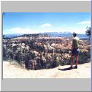
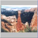
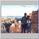
of extreme temperatures on the porous rocks. The highest point, Rainbow
Point, at the end of the 18 mile scenic drive ( where you turn round
and
come back) is 9,115 feet above sea level and most of the rim is above
8,000
feet. On the way to Bryce from Springdale we drove past Red Rock
Canyon,
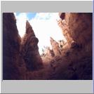
where we returned in the dark to eat our picnic dinner! The air is
fantastically
clear up here and we saw Navajo Mountain 82 miles away - on a "good
day"
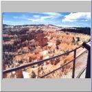
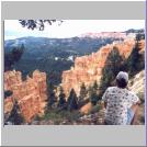
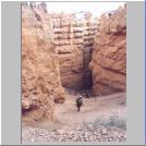
one can see for 150 miles. As well as marvelling at the rocks we
encountered
the Bristlecone Pines which were 1,500 years old. The ultimate
highlight
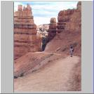
was our walk down into the "Canyon" on the Navajo trail at the end of
our
drive (having stopped at most of the look-out points!) . Boy, was it
hot,
even at 5pm!
Click on the
thumbnails
for a bigger view